station 1: the map
Look at the top map on the wall between the window on the left and the main door on the right.
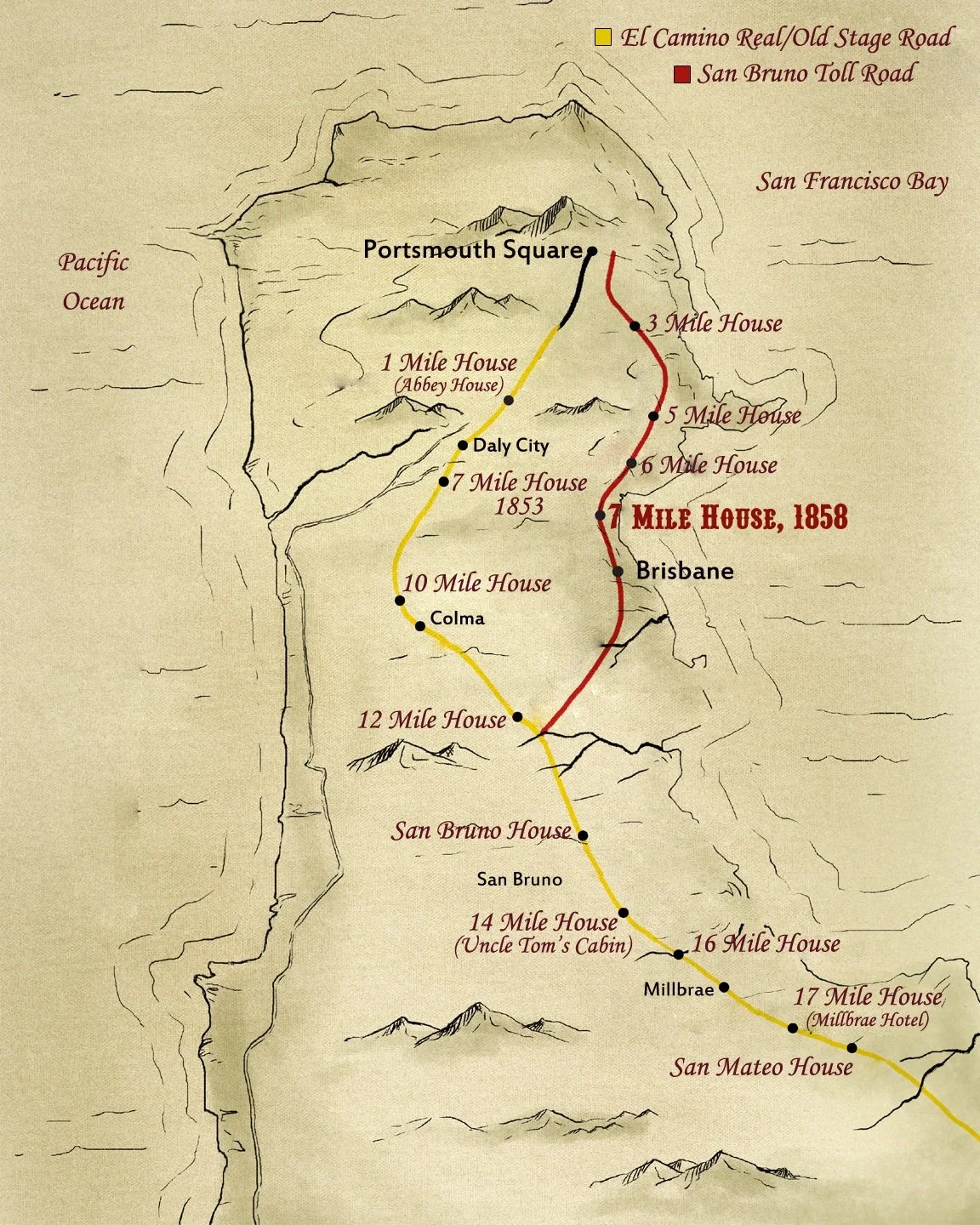
This map explains why we are called 7 Mile House. “Mile Houses” were established during the Gold Rush at every mile from San Francisco to San Jose. They served as a stagecoach stops, pony express routes, bars, hotels, restaurants, and brothels. In 7 Mile House’s case, it was all of the above at different points in history. (Yup, there’s a small room upstairs where some illegal action used to occur!)
You’ll see that the map shows you its starting point in San Francisco, specifically at the historic Portsmouth Square in Chinatown, SF’s first public gathering place or town square, officially designated in 1835.
From there, the original route (in yellow) went down Old Mission Road to Daly City’s Top of The Hill then down to San Bruno on the El Camino and went south towards San Jose. The 7 Mile House on the yellow road was the original one built in 1853, five years before the one you are standing in.
Can you guess how many hours it took to ride from San Francisco to San Jose using this route? Consider this: Imagine yourself in a carriage. The roads are rocky and during the rains, muddy. Your carriage didn’t have suspension so you bounced around in rough roads and you came away with bruised buttocks. Winter travel was worse, when ice became mud and stuck to the horses, wheels and your clothes. And like electric cars of today, albeit not as quick and convenient, your vehicle needed to recharge. With a driver and a horse, they needed to rest more often and nourish themselves with food and water. So now, guess: _____ hours.
It took 9 hours to get from San Francisco to San Jose stopping often in this long, arduous and not to mention, expensive ride costing you $600-$900 in today’s currency. That’s more expensive than a plane ride to Hawaii!
During the Gold Rush, San Francisco grew at 2,000 people a month. Blame the original “forty-niners” and their quest for wealth. This created “traffic”, thus a need for more roads and even a more straightforward route to the south. That’s when the “red road” on the map in front of you was born.
Constructed by 3 entrepreneurs, a short cut was built from San Francisco to San Mateo which connected to the original mile house route and called the San Bruno Toll Road. A toll needed to be charged to cover costs of hiring a workforce, hauling gravel and dirt to fill the marshes, constructing a drawbridge and diverting creeks.
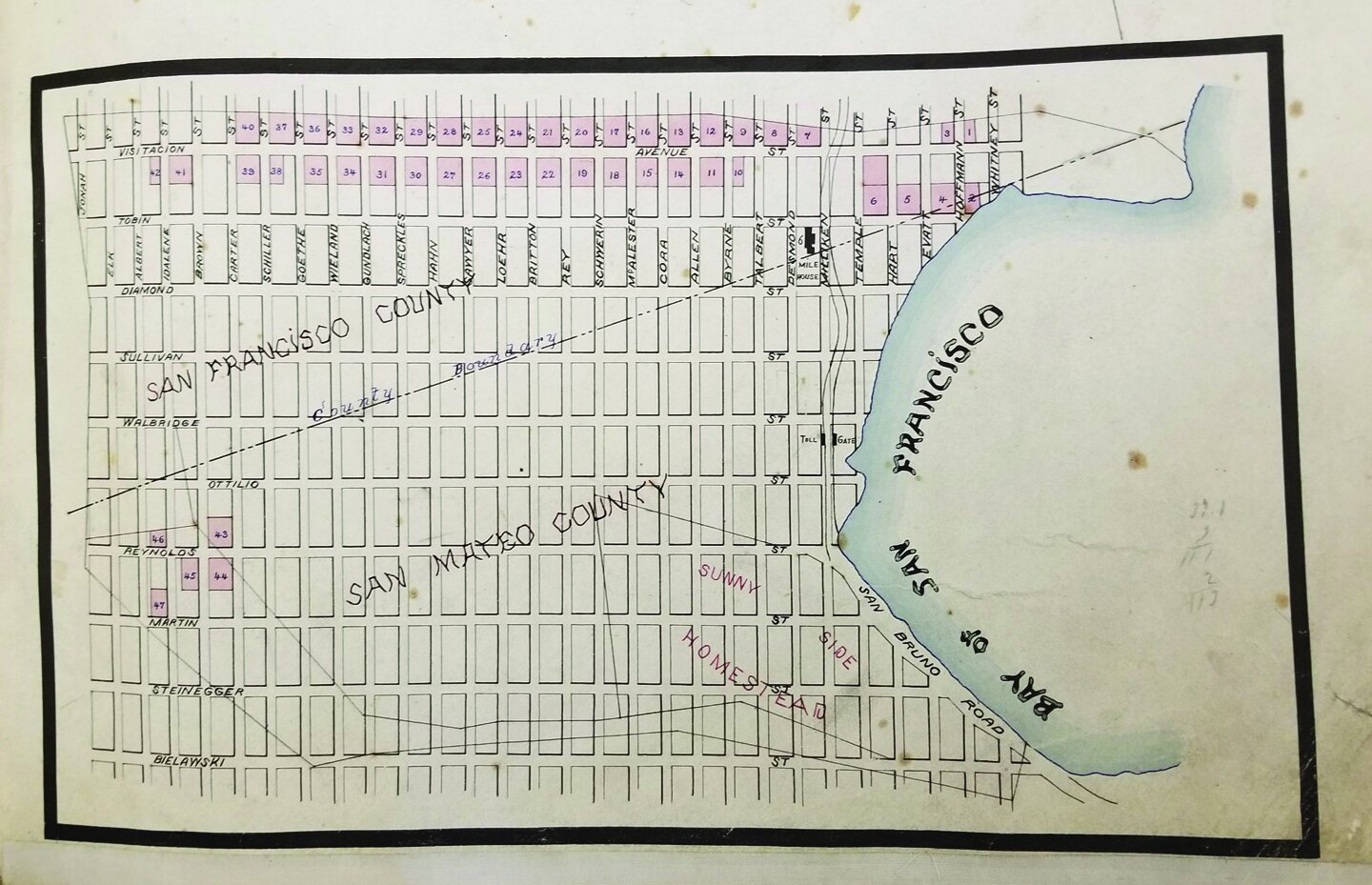
Now look at the frame below the mile house map.
Do you see the “toll gate” in the red circle? That little structure was put up to serve as a toll gate to collect fees as riders passed. No one called it a roadhouse or an inn yet. It would be just over ten years until this little spot in the middle of nowhere would be mentioned in the papers and called by the name it carries till this day: a mile house — the 7 Mile House to be exact.
NEXT STOP: THE PHOTO
Walk towards the right end of the bar towards an old black and white photo titled, “The historic Seven Mile House Since 1876”
Tour Map